


May 9, 2023
Nuxt 3 vs Nuxt 2: What’s New And Improved
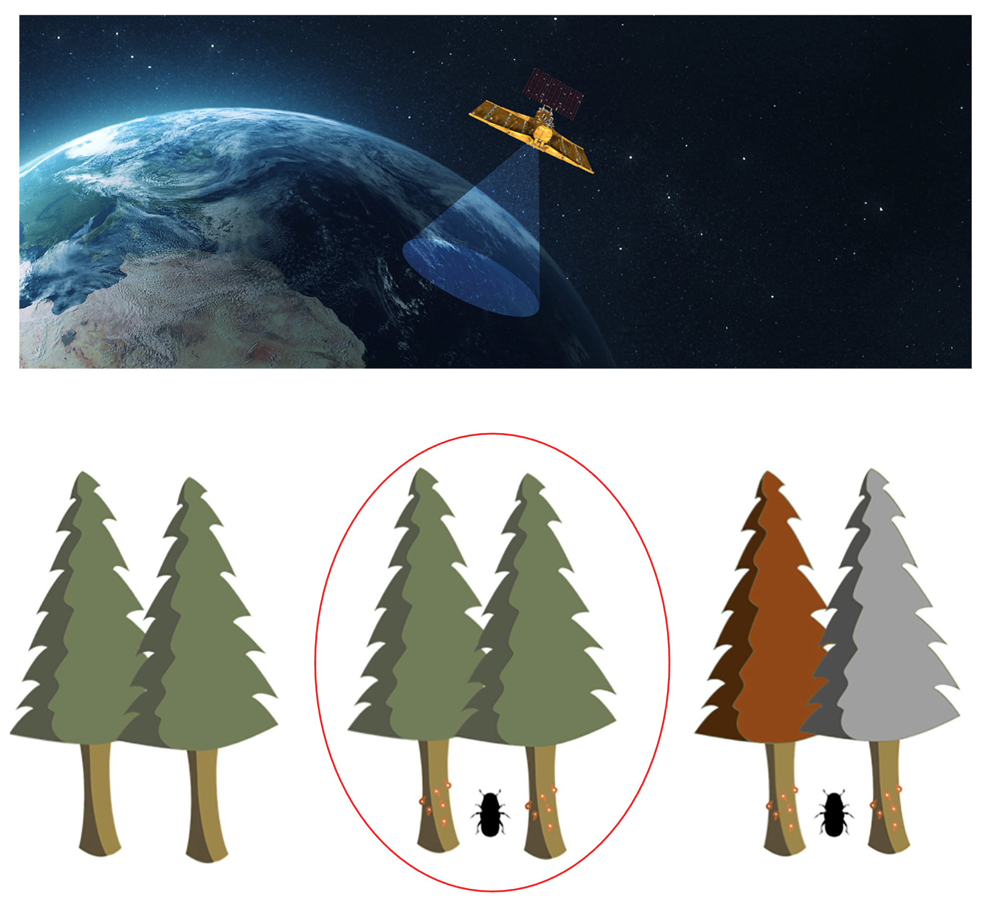
The spruce bark beetle (Ips typographus) has become one of the most destructive threats to European forests. Warmer temperatures, extended droughts, and storm damage — all intensified by climate change — have allowed beetle populations to grow rapidly.
In 2023 alone, it is estimated that 30 million cubic meters of spruce wood were lost to bark beetle outbreaks across Central Europe. That represents over €3 billion in direct economic losses — not counting ecological damage, increased fire risk, or the long-term costs of forest recovery.
Traditional monitoring methods rely on field surveys and aerial inspections. While essential, they are slow, expensive, and often detect the problem only after visible damage occurs, when trees have already turned red or grey and the infestation has spread.
Our project, carried out by PRIOT Digital Systems under the European Space Agency (ESA), explores how deep learning and Earth Observation (EO) can detect bark beetle outbreaks earlier — ideally while trees still appear green.
Each infection typically follows three stages:
Our goal is to identify signs of stress already in the green phase, before visible discoloration, enabling forest managers to act sooner and limit the spread.
Our models were validated across three key study sites:
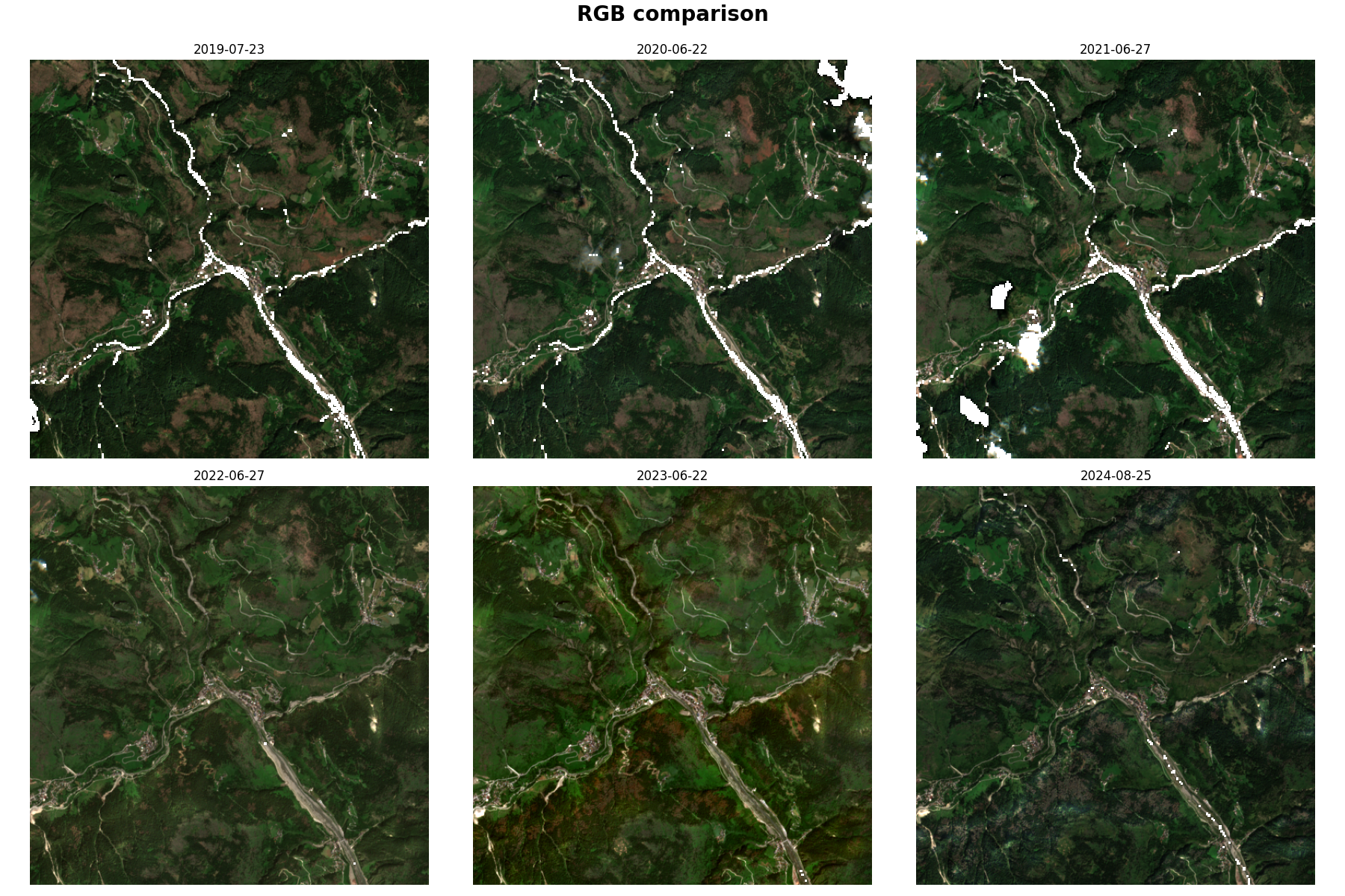
To tackle this challenge, we combined artificial intelligence with Earth Observation data from satellites that continuously monitor Europe’s forests.
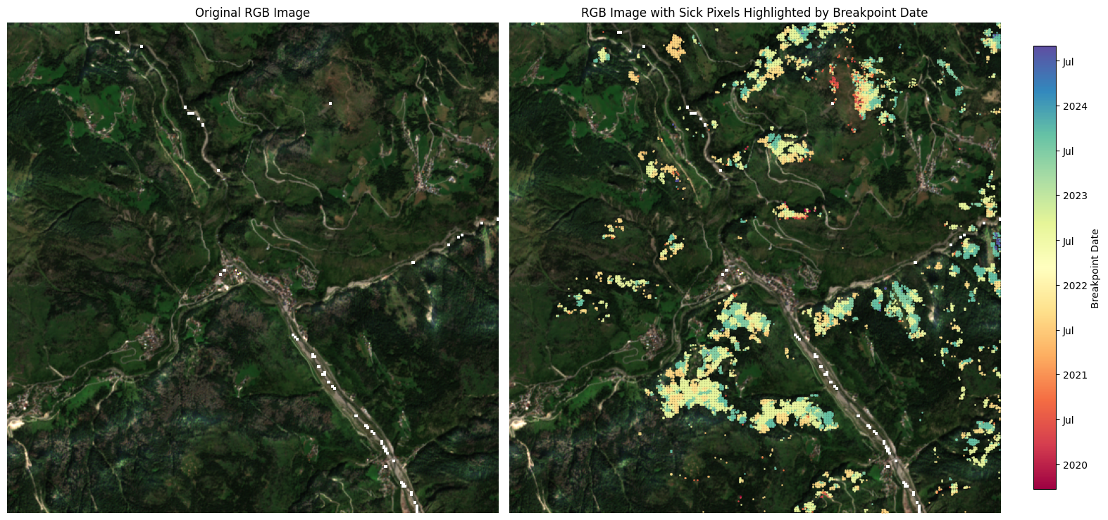
Instead of relying on single satellite images, our approach analyses how forest conditions evolve over time. By observing subtle changes in vegetation characteristics — particularly those linked to canopy health and moisture — the system can identify areas showing signs of stress that may indicate bark beetle activity.
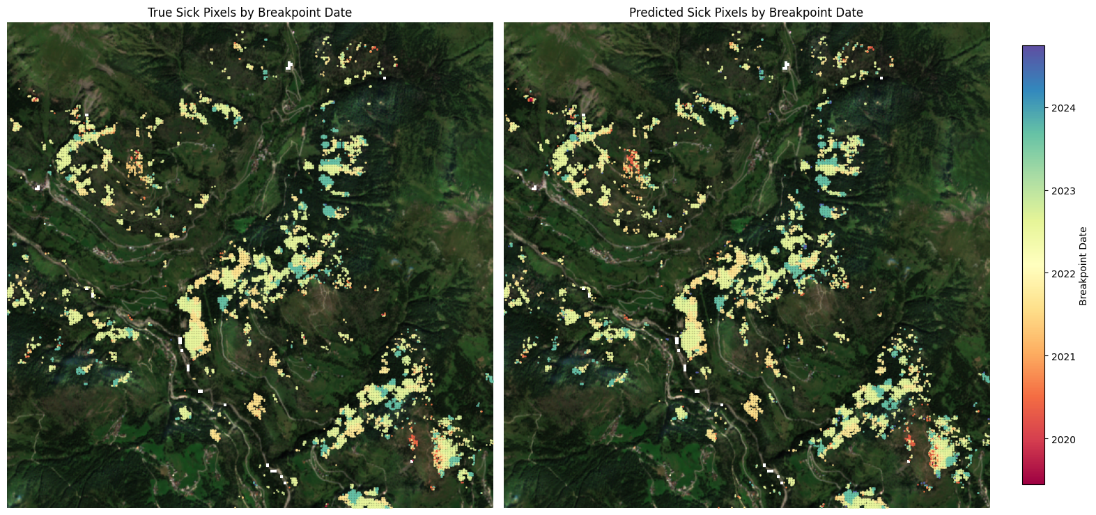
Throughout this process, each satellite pixel is assessed and classified as healthy or affected (sick), creating a spatial overview of forest health across entire regions.
By transforming large volumes of imagery into time-series insights and interpreting them with advanced machine learning models, we can monitor forests on a scale that would be impossible through field observation alone.
This enables automated, large-scale forest monitoring, helping forestry experts focus inspections where early signs of stress are most apparent and respond more efficiently to potential outbreaks.
The model successfully distinguished between healthy and infested spruce stands, even across varying terrain and climates.
We are now preparing the next stage of development, which includes:
We are seeking partners experienced in forestry, Earth Observation, or environmental monitoring to join us in scaling this technology.
If you are a forest owner, research institute, or environmental organization interested in collaboration or pilot testing, we’d love to hear from you.

