From Pilot Corridors to a Nationwide Vegetation Change Atlas
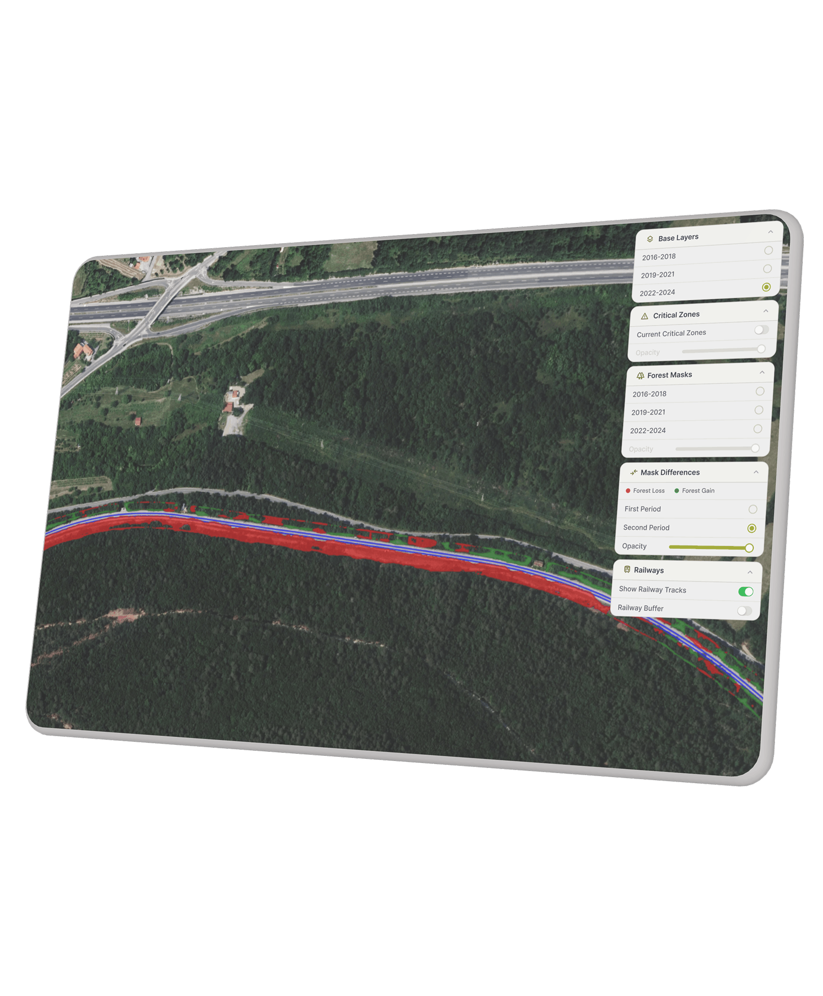
Vegetation growing too close to railway tracks creates operational and safety risk, from encroachment and overhang to unstable trees that can disrupt traffic. We developed a monitoring workflow that uses satellite imagery and deep learning to show where vegetation is growing, receding, or remaining stable along the rail network.
The result Slovenia’s first complete high resolution vegetation change inventory for the railway network, delivered through an interactive map that helps infrastructure teams inspect trackside corridors and plan maintenance more effectively. The same approach can be applied to other linear infrastructure where vegetation control matters, including power lines, roads, and pipelines.
Python
DeepLab
QGIS
Sentinel-2
Geospatial Analytics
Web GIS
UX Research
Prototype Design
UI Design
European Space Agency (ESA)
Slovenian Railways
Benefits
Nationwide Screening
A complete, high-resolution view of vegetation change along the full railway network - not only selected sections.
Clear Change Detection
Automated mapping of forest gain, forest loss, and stable areas across successive imagery epochs.
Corridor-Level Inspection
A dedicated 5-metre trackside buffer so teams can review the strip that matters most for safety and maintenance.
Repeatable at Scale
An automated processing pipeline built for national archives, ready to rerun as new imagery becomes available.
By the Numbers
4 TB
of national orthophoto data processed through an automated pipeline.
2015–2024
vegetation change inventory across the Slovenian railway network.
5
representative corridors used to validate the method before nationwide deployment.
25 cm
spatial resolution used for forest segmentation and change mapping.


